GAP C&O Trip – Day 2 – Connellsville to Frostburg

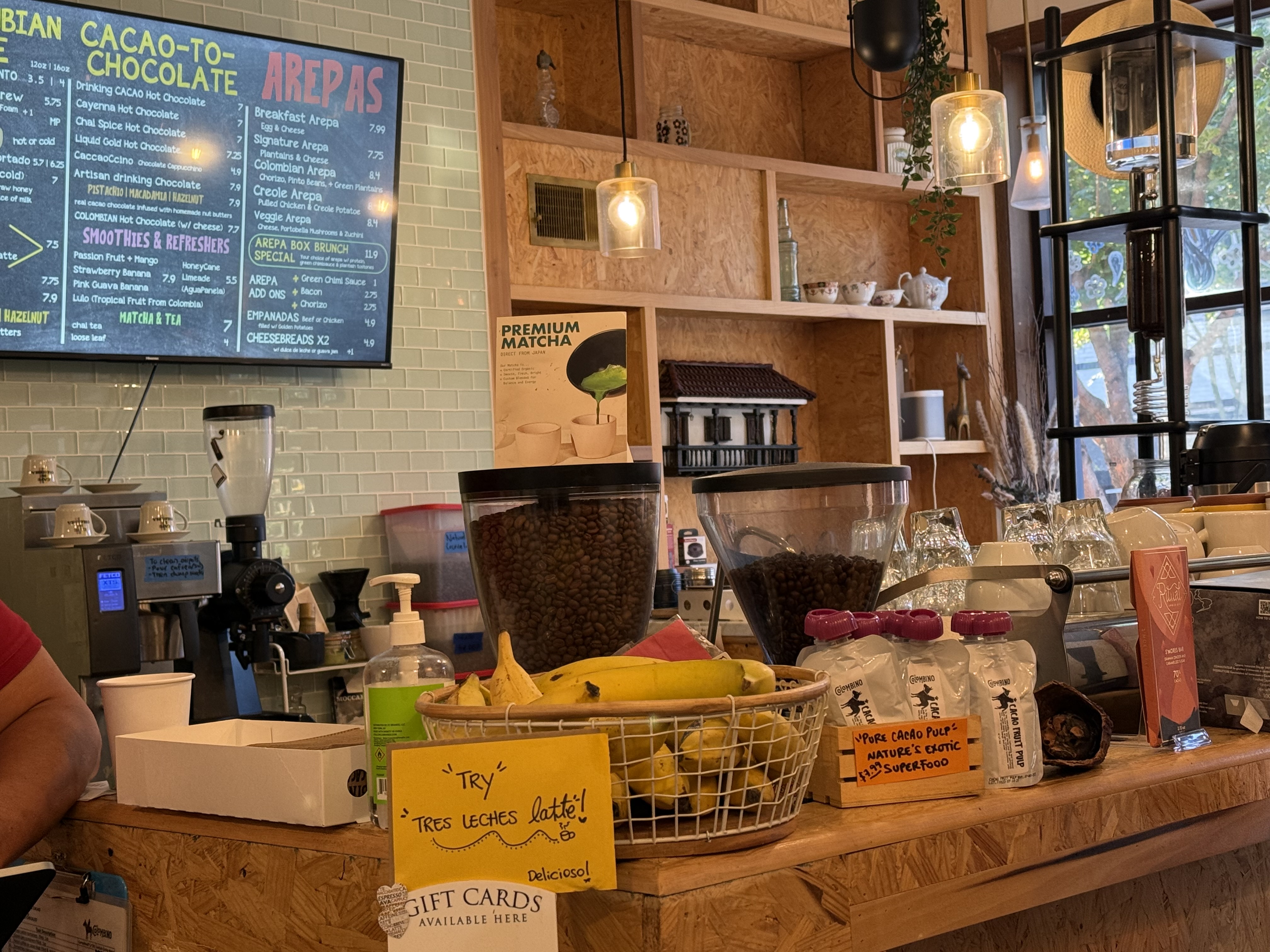
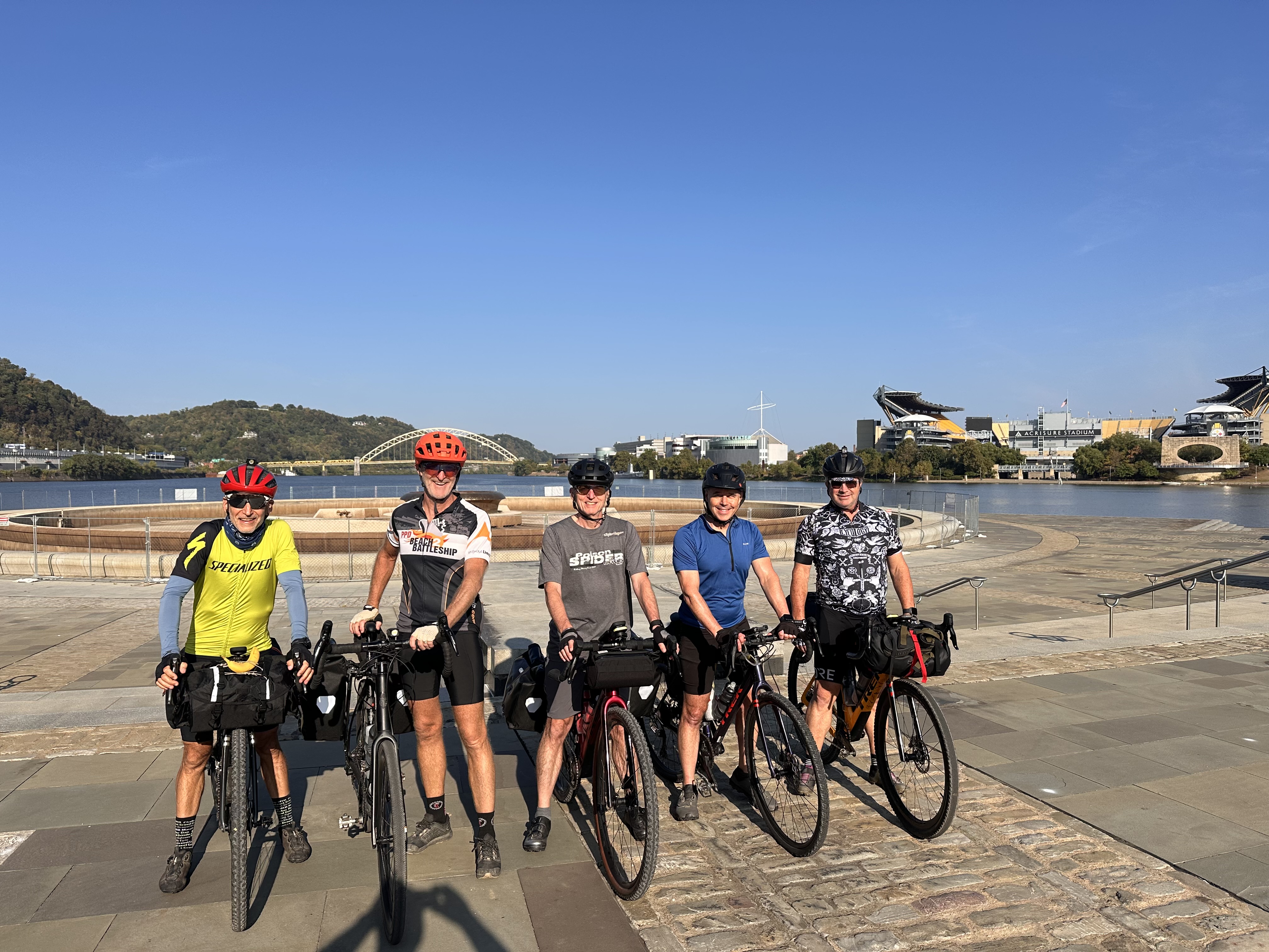
Despite drawing the short straw and sleeping on the couch, I had a pretty decent night’s sleep. Note – trying to find AirBnBs for 5 people is more challenging that you’d think. After coffee at the eclectic Crawford Coffee followed by a decent breakfast in the Valley Dairy we packed up and got back on the trail – rode the first few miles with a couple of riders from Texas and Canada. Today was going to be our 2nd longest day in the saddle (76.8 miles) and slightly uphill to the highest point of the ride at the eastern continental divide.

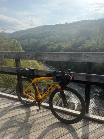
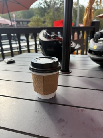
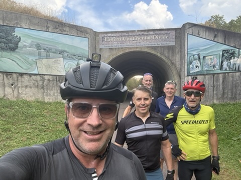
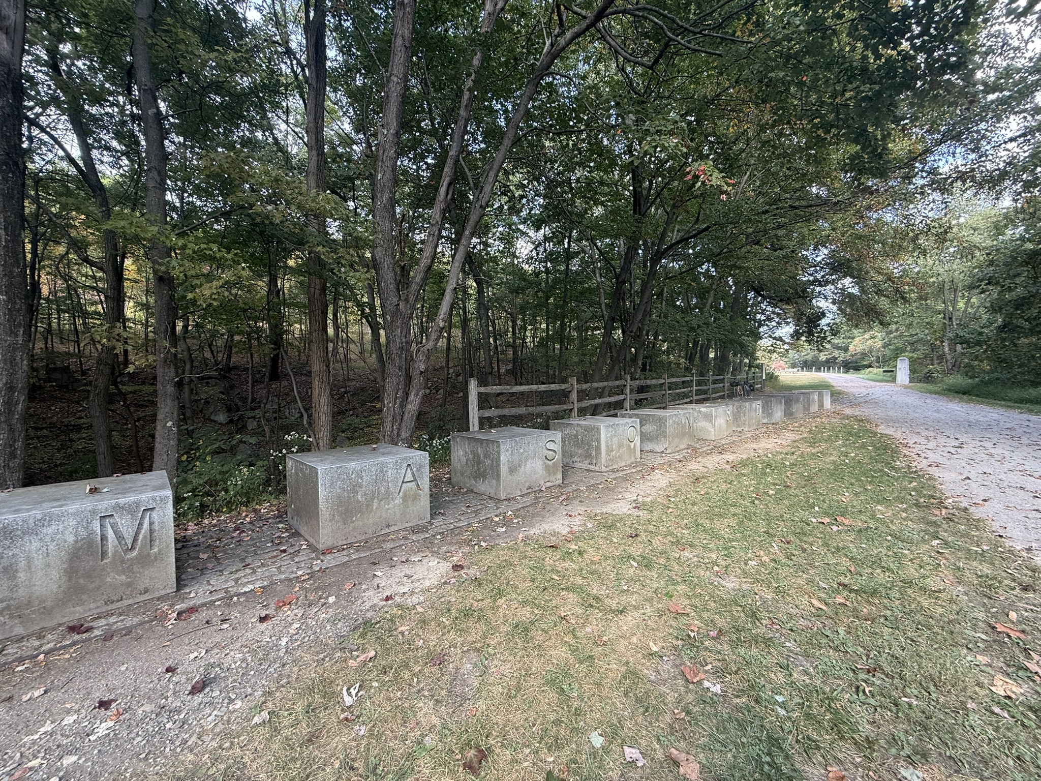
On the way we stopped for views of the river from the many steel bridges and stopped for a coffee break in Ohiopile then onto the Eastern Continental Divide (water at this point flows into the Gulf of Mexico on one side and the Atlantic on the other). Through the big savage tunnel (one of three long tunnels – you’ll be glad you bought lights!) then some history / culture as you cross the Mason-Dixon line. A punchy set of climbs off the GAP Trail got us to our rest stop for the night in Frostville – the very funky Allegheny Trail House. We were all pretty starving after a long day in the saddle – so a quick shower, hosed the bikes down and headed for dinner at the local Mex followed by the usual end of day entertainment – 5 Crowns !

Strava link is here.

Day 3 – Frostburg to Hancock (77.3 miles)

GAP C&O Trip – Day 1 – Pittsburgh to Connellsville

We kicked off the start of the adventure with a decent breakfast and some Columbian coffee in the Northside of Pittsburgh then rode down to start / end of the GAP in Point State Park at the confluence of the Monongahela and Allegheny Rivers. Unfortunately the fountain was under repair so I guess we’re going to have to return for the group photo at some point.

First day’s riding was pretty easy (63 miles, flat to slightly up hill) and weather was perfect. We stayed in an AirBNB right on the trail in Connellsville, had a couple of beers, and dinner at the River’s Edge as the Youghiogheny River and freight trains on the railroad rolled by.

Strava link for more details is here.

Day 2 – Connellsville to Frostburg (76.8 miles)

GAP C&O Trip – logistics / gear

This years boys biking trip was a bit of a departure from the usual red sandstone and desert of the South West – instead, we planned to ride the 330 miles from Pittsburgh, PA to Washington, DC on the GAP (Great Allegheny Passage) and the C&O (Chesapeake and Ohio) Canal towpath.

The 150 mile Great Allegheny Passage follows a railway corridor through wooded hills and small towns, reaching the Eastern Continental Divide before descending into Maryland. After Cumberland, Maryland, the route shifts onto the C&O Canal Towpath, traveling 184 miles along the Potomac River through peaceful forests and rural countryside all the way to Georgetown. Interactive map here.

Logistics

We drove gear and bikes to DC on the Friday and organized a shuttle to Pittsburgh on the Saturday – breaking up the trip over a couple of days avoided spending 10+ hours driving. We were able to leave a vehicle and post-ride gear at a friends house in the DC suburbs which helped tremendously.

We planned for 5 days of riding and here’s the day-by-day account:

Packing and Gear

As we were staying in rental house, B&Bs with washing machines and dryers and eating our meals out, we were able to pack pretty lightly. I packed about 13lbs of gear:

  • 2 days of cycling gear (with layers for different temperatures)
  • 3 days of non-cycling gear
  • spares and tools divided amongst the 5 of us
  • snacks, toiletries, first aid kit

Instead of traditional paniers, I opted for a smaller saddlebag and bar bags, specifically :

  • Revelate Designs – Spinelock 10L saddle bag on the back for stuff I’d only need at the end of the day (clothses. toiletries, charging cables, etc)
  • Revelate Designs – Harness and Saltyroll on the front for stuff I may need during the day (tools, spares, warm clothes)
  • Revelate Designs – Mag Tank – for tool kit, snacks.
  • Outer Shell – Stem Caddy – for quick access to rain jacket, headphones, cellphone

I used everything in my packs except a down vest that was good for additional padding so not a complete waste.

The other 4 riders in my party opted for traditional racks and Ortlieb waterproof panniers and I’d say 70% of other riders we met did the same. My reason for choosing bar and saddle bags we’re, in no particular order:

  • keep the weight down
  • lack of mounting options on my Checkpoint
  • ability to use the same bags on my mountain bike

Bike is a pretty standard Gen 2.0 Trek Checkpoint SLR 6 AXS, with an ISM 2.0 saddle and a Garmin Edge 1050.

Grand Canyon North Rim 2024 – Part 3

Day 6 Rainbow Rim south to Timp Point

The next two days we rode the Rainbow Rim Trail which 18 miles of trail and a mix of forest single track and cliff side trail with stunning views. There’s quite a lot of up and down which if you’re not used to the elevation makes it feel harder than it is – but it’s all easily rideable with good lungs and legs.

Friday’s ride was 20 mile loop from our camp at Locust Point, south to Timp Point on the rainbow rim trail and returning on Forest trails. There are plenty of places to stop for a breather and take in the awesome views. Strava Activity

Post dinner entertainments was provided by the sunset, campfire, and some evening star-gazing.

Day 7 – Rainbow Rim north to Parissawampitts Point

On Saturday we packed up our gear, had breakfast and the rode the northern section of the rainbow rim trail to Parissawampitts Point and then back via the same route. There was a bit more climbing and for some reason I found this the hardest day. Strava Activity

Back at the (now decamped) camp – we scarfed down some lunch, racked the bikes and started the journey back to civilization. Iain, Bryan and I all had red-eye flights that night and were hoping to get back to Salt Lake City with enough time to get dinner and a much needed shower in the Centurion Lounge at the airport.

All in all – this was a pretty awesome trip – we jammed a lot into our 3 acclimation days and the North Rim didn’t disappoint – great riding and incredible views. If you are interested in this kind of multi-day bike trip – I’d highly recommend RimTours – this is my 4th trip with them and I suspect I have more in the future.

Grand Canyon North Rim 2024 – Part 2

Day 4 – Arizona Trail to East Rim

After another good breakfast at Cafe Feellove in St George, we headed over to the Red Lion Hotel to meet our fellow riders, and our RimTours guides – Beth, Birdie, and Lauren. After meeting the crew we loaded our gear onto the trailer and headed to our start point 2 hours away on the Kaibab Plateau.

We stopped briefly at the Jacob Lake Visitor Center to pick up three more riders and drop our rental car. then another short drive to pick up the Arizona trail once we got our bikes setup.

The first day was pretty light (just 14 miles) but had a couple of short technical climbs. All the riding was between 8500ft and 8800ft and this was my first exposure to strenuous exercise at a decent elevation. Our guides warned us to take it easy on the first climb – I really had no choice – it felt like I was breathing through a mask ! After a quick lunch stop and more bike adjustments, on to our campsite for the night at the East Rim Overlook. Note – campsites here are basic – usually just a sign telling you where you can and can’t camp. No pit toilets, no water, no shelter, no network. You have to bring everything you need with you – or in our case pay RimTours to do it !

Strava Activity

Day 5 – East Rim to Rainbow Rim

Still on East Coast time, I was up early enough for the sunrise yoga / stretching overlooking the Colorado river. The 4th picture below is the site of our “Groover” which seems to find the most scenic viewing spots one these trips. After breakfast and decamping – we jumped back on the Arizona Trail. We had a much longer ride (32 miles) – some single track, some high-prairie, and some forest service roads. We peaked around 9000ft but ended the day at Locust Point campsite around 7600ft. Fortunately for my lungs – not much climbing but it was a long day of riding and once we had setup camp and eaten another awesome dinner prepared by our guides – it was time to grab a beer and watch the sunsetting.

Strava Activity.

Grand Canyon North Rim 2024 – part 1

Day 1 – Travel and Zen

This year’s south west mountain bike trip started with a few days acclimating to the heat and altitude in St George, Utah. We picked up rental bikes pretty much as soon as we got into town after the 2 hour drive from Vegas. We rented the bikes and a 4 bike rack from Red Rock Bikes in nearby Hurricane – great shop with friendly staff who helped us get everything set up. We had a longer ride planned for the next day but after a day of travel were keen to get out and ride despite the 100F+ temperatures. After a bit of driving around we found the trail head parking for the Zen Trail – a fairly short, climby, technical trail just outside St George. The trail isn’t well marked and the whole area is covered in trails and not surprisingly we went off course a little and after all the climbing I managed to split my tire and couldn’t fix it on the trail so had to waste the wonderful downhill section. Strava activity.

Day 2 – Wire Mesa

On Monday (Memorial day) we met up with David and headed to Wire Mesa – it’s a smaller, less exposed version of the better know Gooseberry Mesa and in the same general area. Getting to the parking lot is a bit of an adventure but well worth it – I could ride this kind of trail every day of the week – technical enough that you have to pay attention and choose your line, but completely rideable. The views of Zion and surrounding area were stunning – photos just don’t do it justice. We dropped the bikes back to Red Rock in Hurricane and hit River Rock Roasters for lunch. Strava Activity

Day 3 – The Narrows, Zion

It was a toss up between hiking Angels Landing and The Narrows and The Narrows won. We got to the already fairly full main parking lot about 7am and jumped on the 45 minute shuttle to the start of the river trail (Temple of Sinawava). We’d already unwittingly made our first mistake in our rush to get on the shuttle – we didn’t rent hiking staffs – only Iain had hiking poles, Brian and I had to make do with whatever improvised walking poles we could find on the river bank. Unless you’re an aquatic mountain goat – I wouldn’t recommend hiking the narrows without a staff or hiking poles.

We didn’t quite get to “Big Springs” (the end of the trail) due to high water and strong currents – we’d already swam / waded chest deep in some sections and it was becoming cold and tiring. We did explore the smaller “Orderville Canyon” on the way up – a beautiful side canyon with fewer people and no wading. In all we hiked just over 12 miles in 5.5 hours. For hike that is pretty much flat – it was pretty strenuous and difficult underfoot – I’m still surprised my weak ankles and knees held out.

Note – you can see the sections where we had to swim on Strava as it sent the Altimeter on my Apple Watch haywire.